|
"Les femmes en route
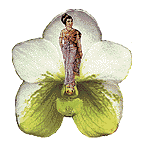
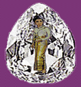
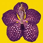
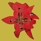
are represented by ink jet figures taken
from Thai postage stamps. Each figure is placed inside a metaphorical
icon, either a faceted teardrop diamond, which represents a precious
commodity, or an orchid, which represents an exotic and foreign origin.
This series of work is a mapping of the global trafficking and its networks.
I chose two Pacific-centered world maps to draw the routes. One map
is a drawing of the travel routes radiating from the trafficking-source
countries (Continent of Asia) at the center, to the surrounding receiving
countries (Continents of Europe, Americas, and Australia). The second
map is a decorated drawing of the migration web, with distances of mileage
designated, between countries. I also found a 1960 Encyclopedia Britannica
World Atlas in a used bookstore. Its dedication page has a "utopian"
mission statement calling for universal understanding. This hopeful
statement, made at the time during the beginning of the Vietnam War,
convinced me to purchase it for this project. I transformed it into
a diary, a collage travelogue. Inside are collages of the women travelers
traveling over pages of population, birth, and death rate statistics,
time zones, oceans, trade and transportation terminal maps."
|
|
"The migration theme involves narratives ranging from local to global perspectives. It includes personal and international politics. I searched the Internet for current news, critical studies and essays posted on Websites concerning trafficking and migration and used it for artwork content. Individual circumstances transform into the collective experiences. They are expressed in statistics and numbers to demonstrate the magnitude of this topic. The most engaging, and disturbing are writings about trafficking of women for labor and the sex industry." |
|
Distribution of Age of Larger Cities Proportion of Working Population in Industries
|
||||||||
|
||||||||
|
Pacific Centered Wall Map, 2001 - 42" X 56"
|
|
The Jefemon Collaboratory on the animated flowery tip - please click for a psychedelic trip |
| return to Skowmon Hastanan site |


